Updated at 12:49 p.m.
By Sharyn L. Decker
Lewis County Sirens news reporter
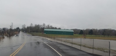
The city of Centralia announced this morning the activation of its Emergency Operations Center because of high waters in downtown.
Numerous streets are shut down, and authorities remind the public that driving past a road closure sign can result in a $124 citation.
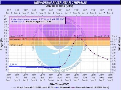
China Creek has overflowed its banks. A flood warning was issued this morning for the Skookumchuck River, with minor flooding expected in Bucoda. A flood watch remains in place in Lewis County.
Motorists are asked to slow down when driving through standing water on city streets. The wake from vehicles can push additional water into houses and adjacent property, Officer Patty Finch says.
It’s also not safe, according to Finch.
“Going too fast can cause drivers to lose control of their vehicles,” Finch said in a news release.
Closed as of 12:15 p.m. are:
• Centralia College Boulevard – from Ash Street to Iron Street
• West Main Street – from Iron Street to Ash Street
• West Pine Street – from Pearl Street to Ash Street
• West Magnolia Street – from Pearl Street to Ash Street
• Maple Street – from Gold Street to Washington Avenue
• Center Street – from Railroad Avenue to Washington Avenue
• Hanson Street – from Railroad Avenue to Washington Avenue
• North Gold Street – from Gerard Road to Ham Hill Road
• Scott Johnson – from Kresky Avenue to Gold Street
• Fair Street – from Kresky Avenue to Gold Street
The city of Centralia has sandbags for its residents.
Shortly after noon, Finch said the water in China Creek – the primary problem today – appears to be receding, but levels on Salzer Creek may be increasing slightly.
Finch says those who live on or near a hill at risk for landslides should be aware of the following clues that could signal a problem
• Soil moving away from foundations
• Tilting or cracking of concrete floors and foundations
* Leaning telephone poles, tress, retaining walls or fences
• Faint rumbling sound that increases in volume as the landslide nears
• Unusual sounds, such as trees cracking or boulders knocking together
Monitor the changing conditions for yourself, using links always available on the right-hand sidebar of this news site under “Other useful web links. Direct from the National Weather Service.
• “River levels“: Graphs show you what level your river has been at, where it’s at right now and where it is projected to be.
• “Weather alerts, forecasts“: Click on the map to find your current and forecast temperature and other weather information, as well as alerts for hazardous weather conditions.
• Also, quickly and easily get information directly from others in the community by viewing or joining Lewis County Sirens on Facebook.
•••
For more, read, “Officials offer early information regarding floodwaters” from Monday January 5, 2015, here


 Join us