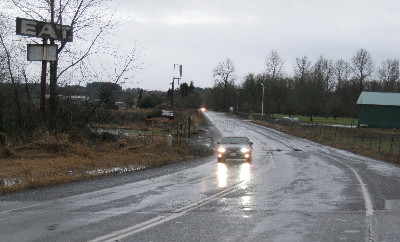
Rice Road in front of Stan Hedwall Park in Chehalis is usually among the earliest places to become inundated when the Newaukum River gets high, and it was passable at 4 o'clock this afternoon.
By Sharyn L. Decker
Lewis County Sirens news reporter
This news story was updated at 6:12 p.m.
CHEHALIS – While the weather service’s mid-day bulletin says heavy rain has returned to the southern tier river basins as a front moves southeast, still only minor flooding is forecast on the Newaukm River near Chehalis.
The National Weather Service now predicts the river will rise above flood stage around 9 p.m. tonight and crest at 10.7 feet about an hour later. Flood stage is 10.5 feet.
At 4 p.m. today, the chief for Lewis County Fire District 6 was driving around the district and said he hadn’t seen water over any roadways. The district stretches from Adna to North Fork Road and includes both the Newaukum and Chehalis rivers.
Chief Bud Goodwillie said he had just come from one Newaukum low spot, Hamilton at Labree Road and it was fine.
Chehalis police Sgt. Gary Wilson said late this afternoon he checked two normally early trouble places – Shorey Road southwest of the Interstate 5 and Main Street interchange as well as Florida Avenue – and found water was high but not on the roadways.
The weather service lists numerous roads and areas around the Newaukum River that would be affected if the water rises to predicted levels such as Jackson Highway and roads such as Rush, Sommerville, Griel, Hamilton, Tune, Tauscher, Guerrier, Kirkland, Macomber, Rice, Senn, Lucas Creek, Middle Fork and North Fork.
The flood warning continues for the Newaukum River around Chehalis until Monday morning.
In the southwest region, a flood warning continues also on the Chehalis River near Grand Mound and Porter.
The weather service notes advisories are in place about small stream and urban flooding across the forecast area. Flood watches are in effect through tomorrow afternoon.
•••
Note: At 5:32 p.m., the weather service reinstated a flood warning at Doty for the Chehalis River. It’s only for minor flooding, but obviously the forecast changes more quickly than I can keep up, and what happens out west affects what happens along the Chehalis River in Chehalis and Centralia. Readers can easily monitor the river levels with the links below.
•••
Read the latest warnings, watches and special weather statements here
Check the river level forecast for your area here
Check the weather forecast or your area here
KOMOnews.com is reporting on water-related events around Western Washington.
Note: Readers can always access the above forecasts from the right hand sidebar on Lewis County Sirens, under “Other useful web links.”

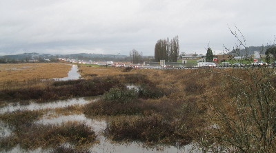
It was not even 4 p.m. today and it was getting dark. Interstate 5 to the north of the 13th Street and Rice Road interchange has a low spot that Dillenbaugh Creek, and subsequently the Newaukum River, have flooded in the past.
Tags: By Sharyn L. Decker, news reporter